Trail Walking La Tour-d'Aigues - PF-La Tour d'Aigues - La Bastidonne - La Chapelle St Julien - Photo

PF-La Tour d'Aigues - La Bastidonne - La Chapelle St Julien

 MicDul
MicDul

User

© OpenStreetMap contributors
Length
Length
14.7 km
Max alt
Max alt
448 m
Uphill gradient
Uphill gradient
302 m
Km-Effort
Km-Effort  
18.8 km
Min alt
Min alt
231 m
Downhill gradient
Downhill gradient
302 m
Boucle
Boucle
Yes
Creation date :
2023-02-07 08:43:23.0
Updated on :
2023-02-08 10:51:48.024

(0 Reviews)

Walking
Walking
4h45
Difficulty : Medium

Scan this QR Code to open this trail in the SityTrail application

FREE GPS app for hiking

Logo SityTrail SityTrail

IGN / Geographical institutes

Download SityTrail from the App Store Download SityTrail from Google Play

Logo SityTrail SityTrail World

The world is yours!

Download SityTrail from the App Store Download SityTrail from Google Play Download SityTrail on Huawei AppGallery

About

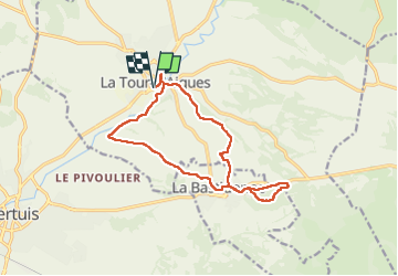
Trail Walking of 14.7 km to be discovered at Provence-Alpes-Côte d'Azur, Vaucluse, La Tour-d'Aigues. This trail is proposed by MicDul.

Description

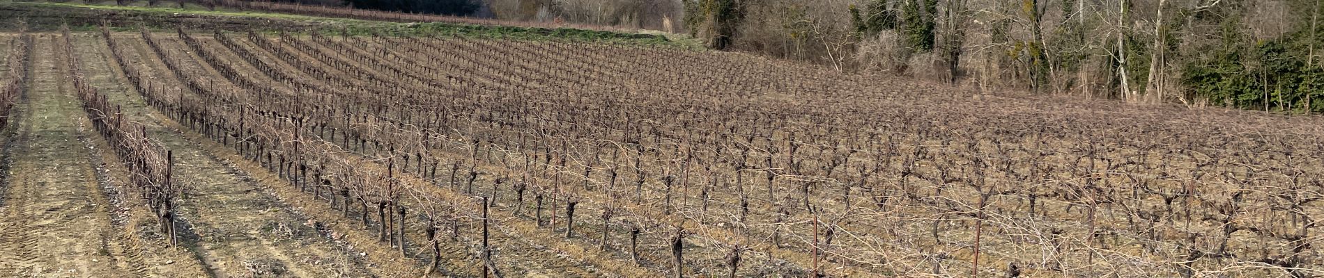
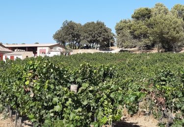
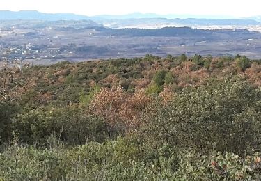
On traverse l'univers privilégié du vin (AOC Luberon) dont les parcelles s'étendent à perte de vue entre La Tour d'Aigues et la Bastidonne.
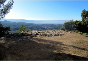
Rando cool, un tout petit raidillon pour atteindre les ruines de la Chapelle St Julien.

Elevation profile

Photos

Positioning

Country:
France
Region :
Provence-Alpes-Côte d'Azur
Department/Province :
Vaucluse
Municipality :
La Tour-d'Aigues
Location:
Unknown
Start:(UTM)
705209 ; 4844304 (31T) N.

Trails nearby

Trail Cycle La Tour-d'Aigues - Le Pays d'Aigues à vélo - Photo
Cycle
GUIDE+

Cycle

Medium
(2)
La Tour-d'Aigues, Provence-Alpes-Côte d'Azur, Vaucluse, France
86 km | 102 km-effort
5h 49min
Yes
Trail Mountain bike La Bastidonne - La Bastidonne 2015 - Photo
Mountain bike
lauramb

Mountain bike

Medium
(1)
La Bastidonne, Provence-Alpes-Côte d'Azur, Vaucluse, France
24 km | 28 km-effort
1h 51min
Yes
Trail Walking La Tour-d'Aigues - Vignes du Château de la Dorgonne - Photo
Walking
counoise

Walking

Very easy
La Tour-d'Aigues, Provence-Alpes-Côte d'Azur, Vaucluse, France
6.3 km | 8.1 km-effort
1h 32min
Yes
Trail Walking La Motte-d'Aigues - Étang de la Bonde - Photo
Walking
pfleury

Walking

Very easy
La Motte-d'Aigues, Provence-Alpes-Côte d'Azur, Vaucluse, France
3.1 km | 3.6 km-effort
40min
Yes
Trail Walking La Tour-d'Aigues - La tour d'Aigues - Photo
Walking
philou-84120

Walking

Easy
(1)
La Tour-d'Aigues, Provence-Alpes-Côte d'Azur, Vaucluse, France
14.4 km | 18.2 km-effort
3h 59min
Yes
Trail Cycle La Tour-d'Aigues - La Tour Cucuron - Photo
Cycle
cathyetyves

Cycle

Easy
(1)
La Tour-d'Aigues, Provence-Alpes-Côte d'Azur, Vaucluse, France
27 km | 32 km-effort
1h 50min
Yes
Trail Cycle La Tour-d'Aigues - En passant par la montagne - Photo
Cycle
cathyetyves

Cycle

Easy
(1)
La Tour-d'Aigues, Provence-Alpes-Côte d'Azur, Vaucluse, France
18.6 km | 23 km-effort
1h 40min
Yes
Trail Walking Grambois - grambois - Photo
Walking
jo-ba

Walking

Very easy
Grambois, Provence-Alpes-Côte d'Azur, Vaucluse, France
14.2 km | 19.6 km-effort
4h 49min
Yes
Trail Walking La Tour-d'Aigues - Chapelle St Julien de La Bastidonne - Photo
Walking
boulinevelyne

Walking

Medium
La Tour-d'Aigues, Provence-Alpes-Côte d'Azur, Vaucluse, France
12.8 km | 16.8 km-effort
3h 49min
Yes


Close
My subscriptions